September 30, 2015

Paradise Bay


“The Earth does not belong to man; Man belongs to the Earth. 
This we know. 
All things are connected like the blood which unites one family. 
Whatever befalls the Earth befalls the sons of the Earth. 
Man did not weave the web of life, he is merely a strand in it. 
Whatever he does to the web, he does to himself.” 
Chief Seattle


We accepted the generous offer of our dear friend Pat to utilize her RV lot in the Paradise Bay development of Port Ludlow. And using her lot as our base turned out to be the perfect decision. First and foremost, her waterfront lot offered a front row view of the Hood Canal of Puget Sound. As we relaxed on her raised patio each afternoon, our unobstructed view of the waterfront and a few special rainbows proved to be priceless…it is so true…location, location, location.


And a short distance down the street was our own private beach along the rocky shoreline. The local part time bubble maker happened to be there to entertain all and any beachcombers during our stay.


Second, Port Ludlow is centrally located to many ports, i.e. Port Gamble, Port Townsend and Port Angeles. The town is situated near the Hood Canal Floating Bridge, which connects the Olympic and Kitsap Peninsulas. Each day we waited for one of the Navy’s Triton Submarines to maneuver through the bridge and down the Hood Canal...but we only got all hot and bothered...no sub cruised by us. We could have hopped on a ferry to Whidbey Island, Seattle or even Vancouver, but decided to stick to the "peninsula" during this stay as we were there over the Labor Day Weekend.  A huge thank you dear Pat for giving us the opportunity to visit some of the most scenic Washington ports and attractions of the Sound.  We'll be baaaaaack!!


On one afternoon we crossed the floating bridge over to the Kitsap Peninsula. We first visited the town of Suquamish and the Suquamish Tribal Cemetery to view the gravesite of Chief Seathl, aka Chief Seattle...for whom the city of Seattle was named after. Than we did a quick tour of the small community or Port Gamble on the northwestern shore of the peninsula. Our visit was brief but interesting, for there is a wide range of historical buildings lining the street for visitors to browse.


In Port Townsend we walked most of the shoreline embarcadero, practicing being "consumers." We did a lot of window shopping, visited a few cool shops and came across some unique items to be used in our rig. 

We bid farewell to this special place called Paradise Bay, the kind neighbors we met and the beautiful views. It was off to explore more of the Olympic Peninsula. We love you Pat!

At Waypoint 47.897902º-122.648622º

September 27, 2015

Little Creek Casino-Resort

"There is an ancient legend of the Squaxin Island People that connects the humans with the sky people. The story is told of a strong (skookum) young man who had become captivated by the beauty of a young Salish woman; she was equally enraptured by his unusual spirit strength. Her ability to run like the wind was known throughout the land; his ability to help people with his spirit power was know far and wide. The young Salish woman was promised to another man in marriage, she had known this for many years. She went on a spirit quest to the cliffs near her village searching for a way to get out of the arranged marriage. Near the cliffs the young man was singing his power song. Using spirit power the skookum man helped the Salish woman to change into the Red-tailed hawk so she could always be near him. To this day near the Salish cliffs, the beauty of the Red-tailed hawk can be seen and heard, nearby the marine waters of Skookum inlet whisper spirit power to those who will listen."


We stopped at Little Creek Casino and Resort in Kamilche, WA to get some laundry done, charge up the batteries and dump our tanks. Kamilche was the first town that we truly became aware of the impact and influence of the state's Native American culture. We would later see that the Olympic Peninsula is dominated by Native American owned land. Tribal headquarters of the Squaxin Island Tribe are located in this town. Little Creek, a development of the Squaxin Island Tribe, the native people of South Puget Sound. They are descendants of the maritime people who lived and prospered along the Sound’s shores for centuries. Because of the their strong cultural connection with the water, the tribe is known as the People of the Water. Little Creek offers a very nice casino-resort, RV park and golf course. The main draw for us to stop here was it’s very comfortable RV park. And best of all, this was a Passport America Membership Park…so we were offered 50% off the regular nightly rate. We would definitely stay at this park again.


We were able to secure two rv pads right next to each other, strong wi-fi signal, close to the bathrooms, showers and laundry facilities, which made our brief stay very convenient. Plus with the continuing rain, we were out of the mud on large asphalt pads and adjoining plush lawns. And the added bonus was the "All You Can Eat" dinner feed (i.e. unlimited King crap legs) for a very reasonable "seniors only" price point. 


A nice leisurely walk from the rv park was the stunning Salish Cliffs Golf Club, one of the top resort courses in the United States. The entrance to the golf course featured some beautiful Coast Salish carvings and totem poles...so very cool! 


While we were in Kamilche, we took a short drive up to the Squaxin Island Tribe Museum Library and Research Center. Known as the "Home of Sacred Beginnings", the shape of the museum's facade represents Thunderbird, an important character in numerous Coast Salish legends. The building contains exhibits, galleries, classrooms, a library, museum store and administrative offices for the Tribe. As the building is beautiful, so be the landscape and water features surrounding it. Very Zen! The design illustrates the relationship between the Tribe and the environment of the South Puget Sound, as well as the atmosphere of a traditional shoreline village. 


Also displayed on the museum grounds were some Coast Salish canoes under a traditional canoe carving shed built with ancient cedar posts and beams over 430 years old. The black painted canoe was hand carved from a 30’ cedar tree log that was 500 years old.

We enjoyed our brief stay at Little Creek but it was now time to skirt the Sound toward Port Ludlow, Washington.


At Waypoint 047.128930-123.104580

September 22, 2015

North Fork Campground


“I only went out for a walk, and finally concluded to stay out to sundown, 
for going out, I found, was really going in.” 
John Muir


We entered the “Black Forest” and stopped at the Camp Host site to inquire which campsite number site we had been assigned (we had made reservations in advance because it was the weekend before Labor Day). Before giving up that information, she let us know that the campground had been placed on notice for a possible evacuation due to nearby fires on the flanks of Mt. Adams, "so don’t get too settled." We got to our site and proceeded to “furnish” our home for the next few days…as we assumed that they would provide us enough time to pack up and evacuate if necessary. Dick and Melinda, who joined us later, were our only neighbor in this almost vacant park. We think the fires may have cancelled some camping plans for many.


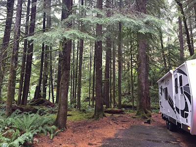
This beautiful campground sits along the north fork of the Cispus River, which we could hear from all parts of the campground. And as lucky timing would have it, there wasn’t a day here that we did not see Coho Salmon spawning up the river. North Fork is situated between three of Washington’s most impressive mountains, Mount St. Helens, Mt. Adams and Mt. Rainer. Shaded by a canopy of trees, this dense forest is a stand of mixed conifers, most of Douglas Fir, but a sprinkling of, Hemlock, Maple and Cedar. The campground also comes with a thick carpet of ferns and vibrant moss. While we were there, it was more apt to being called a rain forest as we saw sunlight only on our day of arrival. After that we had light showers every day and on one evening a nice dump of 6”. Come to find out later it was the same day that they had those destructive winds and rain in the northern part of the state. It has been a long time since we heard the sound of rain, let alone on the roof of an RV and it’s music was magical. And since the upper canopy of the forest was so thick and anything wanting to be sunlight was blocked out by the thick cloud cover, our solar panels were just some bling bling on the top of our trailers. Fortunately we had our “emergency” Hondas to keep our batteries charged.


Within the campground is an old and vacant US Forest Service Guard Station built in 1937. Every vehicle passing through the lower Cispus Valley was required to carry basic fire fighting equipment before they were allowed to pass the North Fork Guard Station in the 1930’s. Over time the original Cispus road which provided access to the high lakes area was abandoned and the station no longer needed. The guard station  has been used more recently as housing for volunteer campground hosts and Forest Service Employees.


We did manage to find a window of opportunity to go on a short day hike. So we donned our rain gear and headed up on the North Fork Loop Trail. This cool trail seemed ominous at first as it climbed 500’ from the campground during the first half mile. But it later leveled out and rewarded us with many spectacular views of the valley below and vivid images of a vibrant and healthy forest.

Across from us was camped a “hard core” off road camper. They were equipped with an off road tent trailer, high off the ground, chrome plating on all four sides, heavy duty rack systems for water containers, gas cans and generator, hitched behind a mean looking 4 wd dodge ram. As the rain gear clad passengers disembarked from this intimating tow machine, out popped two Pugs…definitely not expected (two huskies would be better suited) and they proceeded to walk the campground loop like they owned it. In times past, I would show indifference to the breed, but over the years, Pugs have captured our hearts…Zoey, Sally & Annabelle and now Lemon are our “grand dogs”…and seeing their cousins prance in front by me in this isolated rain forest, validated that the “Girls” could go anywhere!


Although the campground stayed dark until late morning and kept us damp with the constant drizzle we entertained ourselves our entire stay. We even had time to play one of our favorite games, hand made by our dear friend Frank, appropriately named Pegs and Jokers. And Frank, please let Gwen know the boys walloped them girls this time and it felt real good!


The day we left North Fork felt pretty good for no sooner did we hit the open road that we gazed upon some open skies, patches of blue and a few warm rays of sunlight. Mt. Rainer was still shrouded by fog and clouds, so we chose to head west. A visit to that majestic peak will have to wait until our return visit. We stopped at Copalis Beach for a night to enjoy some open skies, long stretches of beach, the smell of sea air and the sound of pounding surf. The rain god did not need a change of scenery, so the showers never ceased. It looked like that “magic sound” of raindrops on our rig was going to be playing for quite awhile.


Here is another RV/camp item that we highly recommend…solely because we use it all the time. Normally at night we choose to light our trailers with the soft glow of candles or for reading, small LED lamps. Well my “Brother” Phil gifted me this cool little lantern, the Black Diamond Moji Lantern and it has quickly become one of our favorite camp lights. We love it because it is simple, bright and compact. The LED bulbs put out 100 Lumens of ambient light, weighs only 3 oz. and it features a dimming switch. Imke just hangs it above our bed via the lantern’s collapsible double hook and she has a wonderful nighttime reading light. We also use it outside, either hanging it from our awning or placing it on one of our tables. You gotta have it!

At Waypoint 46.45083-121.78778

September 18, 2015

Shunpiking 101

"Not all those who wander are lost."
J.R.R. Tolkien


Crossing the Interstate 205 bridge into Washington with the Fox in tow was a long time coming and we couldn’t wait to leave our signature on the many new adventures to be had. We stopped in Cougar, Washington for the evening to prepare our rig for a few days of dry camping. As we had some time to explore, we drove into the southern area of Mount St. Helens National Volcanic Monument and completed a couple of short hikes.


The first one was The Trail of Two Forests. Along this short loop trail we traveled through an old forest now cast in stone from an ancient lava river that spilled down the flanks of Mount St. Helens 2,000 years ago. Now you have an emerald forest that has risen from the black basaltic lava.


Hardened lava holes created where ancient trees stood, the wood trunk burned away, are everywhere along trail. There is also a long lava tube that “kids” can climb down in, through it and out again. 


We than challenged ourselves with a steep, but very short hike to a secluded viewpoint of Mount St. Helens. Since both these trails are located in the National Forest and not inside the National Monument boundaries, they are dog-friendly. Sydney loves joining us wherever we go! On our next trip to Washington, we will be sure to add time on the Western side of Mount St. Helens to learn more of the awesome and devastating event that truly demonstrated the force of nature. 


But this post has to be dedicated to the “ride”…the getting to our next destination. Over the years, the Rauschers have convinced us that the most qualitative way of getting from point A to point B is a mode of travel coined “Shunpiking.” According to Wikipedia, the term Shunpiking has come to mean “an avoidance of major highways in preference for those scenic interludes along lightly traveled country roads.” We now try to practice that mode of travel as often as possible and love to see our GPS stumped. And this is why Forest Road 25 in the Gifford Pinchot National Forest came into play.


We cannot say we were not warned about this road by locals, US Forest Service staff or passing travelers...yes, about everyone we asked about the condition of the road indicated that it would be a "wiser" choice to take Interstate 5 north instead. Feedback was consistent..."Forest Road 25 is very rough, bumpy, not always wide enough for an rv and can have some strong cross winds." But everyone also added, "the ride is sooooo scenic and fun."  
Well, we sorta ignored all the conservatives and placed the greatest value on the words scenic and fun. Plus, with us being experienced mountain drivers who drive attentively, slowly and are towing a mid-sized trailer, what can go wrong that we can't handle?"


All the reviews of Forest Road 25 were true, plus some. I never saw so many 5 mph signs through turns that were shaped liked an upside down V or “speed bumps” seemingly placed by nature in the middle of a straight stretch of asphalt marked 40 mph. But it was all worth it! The scenery was just as spectacular as the bumps on the road. And we had added validation of just how well our trailer was made.


Stopping at a awesome viewpoint, we opened our rig to the only casualty of this road. The top two cabinets above our kitchen sink popped open during “Mr. Toad's Wild Ride” and spilled it’s contents all over the floor. What a mess…a broken glass, opened spice jars, kitchen plates strewn throughout the dining/living area…wow. But we had a trusty hand vac and after gathering all the loose peppercorns, picking out the broken glass and sweeping up the dark red paprika, our vac and a wet swifter finished the job. A few adjustments on the cabinet snaps corrected the situation by providing some extra firmness. But to be safe and have some peace of mind, we took the advice of our dear friend Sonny, and bungeed the two doors for a “no doubt about it” secure closing. With the clean-up done, we finished the last few miles of this bone jarring ride and made the turn off to North Fork Campground in the Gifford Pinchot National Forest.

At Waypoint 46º02’60.00” N -122º18’14.76” W