"My favorite places on earth are the wild waterways where the forest opens its arms
and a silver curve of river folds the traveler into its embrace."
Rory Maclean
I believe each one of us has to earn the right of passage, a passion to embrace...a stamp of of existence. If we don't earn that, we don't deserve the path...we forever live in the present or worse yet, we only live in the past. A river flows relentlessly and purposelessly, but it follows a path and when it tires of one journey it forges through the trials of life toward a new way. Rivers...how I love them all. Rivers move, no matter the atmosphere. If it's raining, lightning or grey...it moves. Ah...like a life without a purpose.
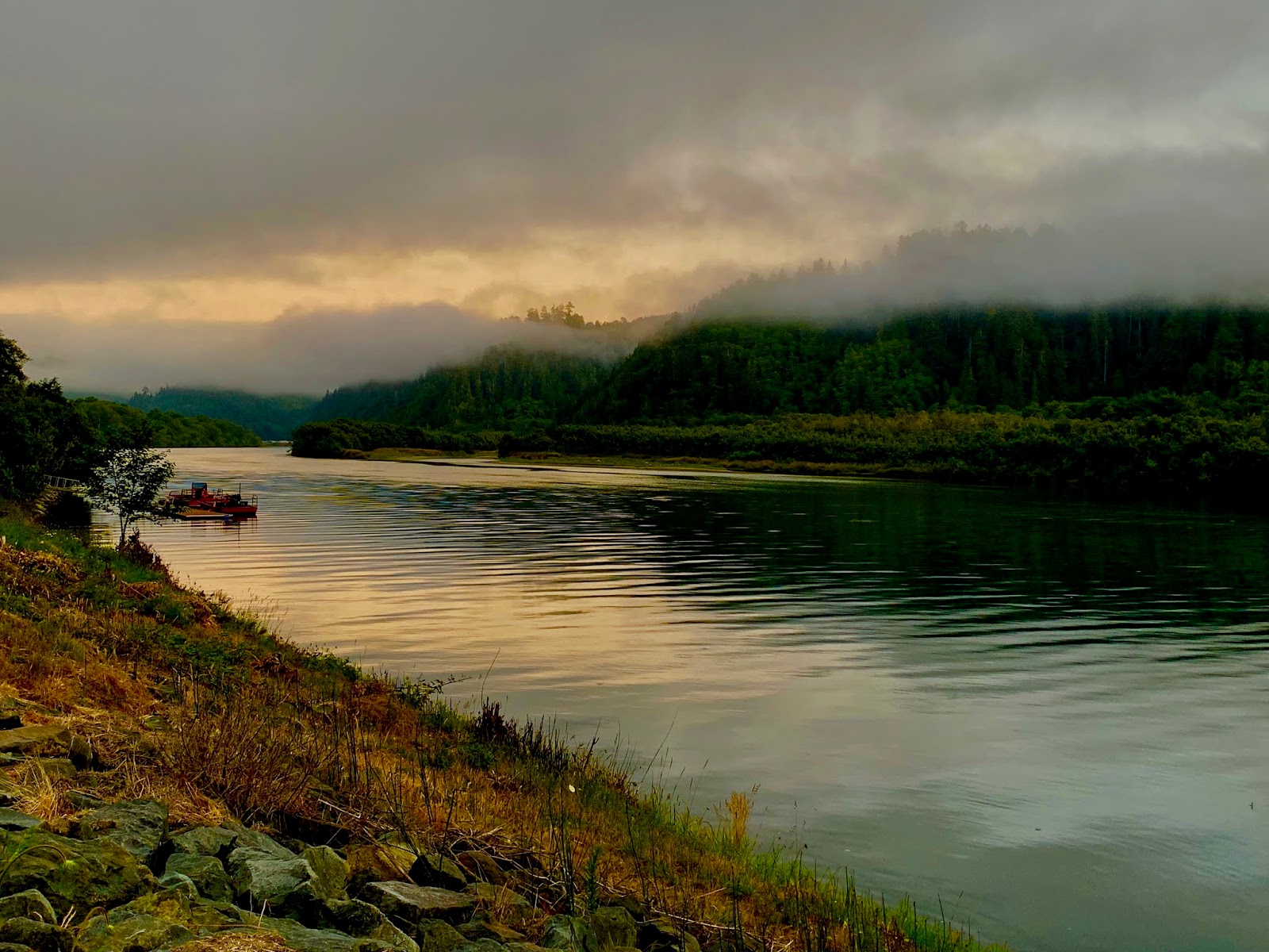
The Klamath River, a federally protected "Wild and Scenic River," is one of three rivers flowing from the Cascade Mountains and reaching the Pacific Ocean. The river, home to our Native Americans for thousands of years, still rely on and care for the river today. The town of Klamath, on the California North Coast, is situated at the mouth of the river and is within the Yurok Indian Reservation.
Klamath River salmon and steelhead runs were once the third-largest in the nation, but have fallen to just eight percent of their historic numbers as dams block over 300 miles of historic salmon habitat. Our fisherman neighbors shared that their success rate has been hit and miss, due to river's warm water temperatures. Although the Chinook salmon are staying off shore in the cooler water, they did score an occasional fish for the grill.
As our site at, Golden Bear RV Park, was right on the bank of the Klamath, we owned a perfect perch for wildlife viewing. We were told that the Klamath Basin is also home to mule deer, elk, cougar, black bears and river otters. We saw elk grazing on the side of the road, a family of river otters playing on the opposite bank and Osprey. And the neighbors spotted a black bear swimming across the river in front of the park the day before we arrived.
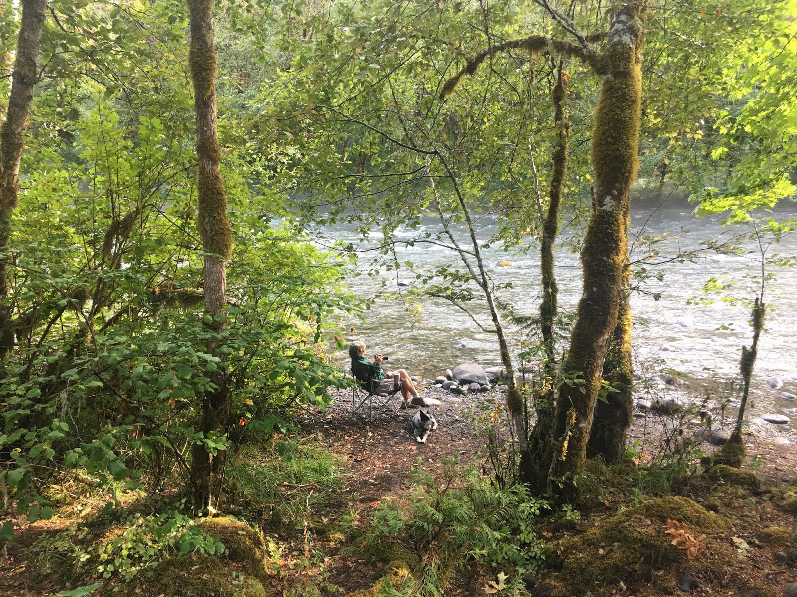
The Rogue River, another river beginning in the Cascades and flowing to the Pacific at Gold Beach. This river became our next host for a few days. Just a few miles up the road from Gold Beach was Quosatana Campground, a very nice National Forest campground with large enough sites to accommodate our beast. It is situated in an Oregon myrtle grove with broad grass meadows on a rocky bank above the river.


Imkelina, Sydney and Kiah spent many hours on the banks of the river, swimming, wading and relaxing in the sun. We had a front row seat to observe the dozens of jet boats flying by with a full load of wannabe white water thrill seekers. Seeing all those jet boats full of passengers, the many kayakers and tubers floating down the rapids reminded us that we all can be on a similar journey, although everybody is in a different place at any given time, and that is to experience whatever and all we can in a natural setting. No pubs here, no recliner and channel changer in hand and no urban settings.


Although we saw a few Osprey soaring up and down the river, we had one particular show that was on our highlight reel. One morning Imkelina spotted about a half dozen turkey vultures on the opposite bank, apparently trying to feed on a large dead salmon. Then, quite suddenly, they all took flight. Just then a massive bald eagle dropped down from the forest canopy and became the new sheriff in town. He now owned the meal.
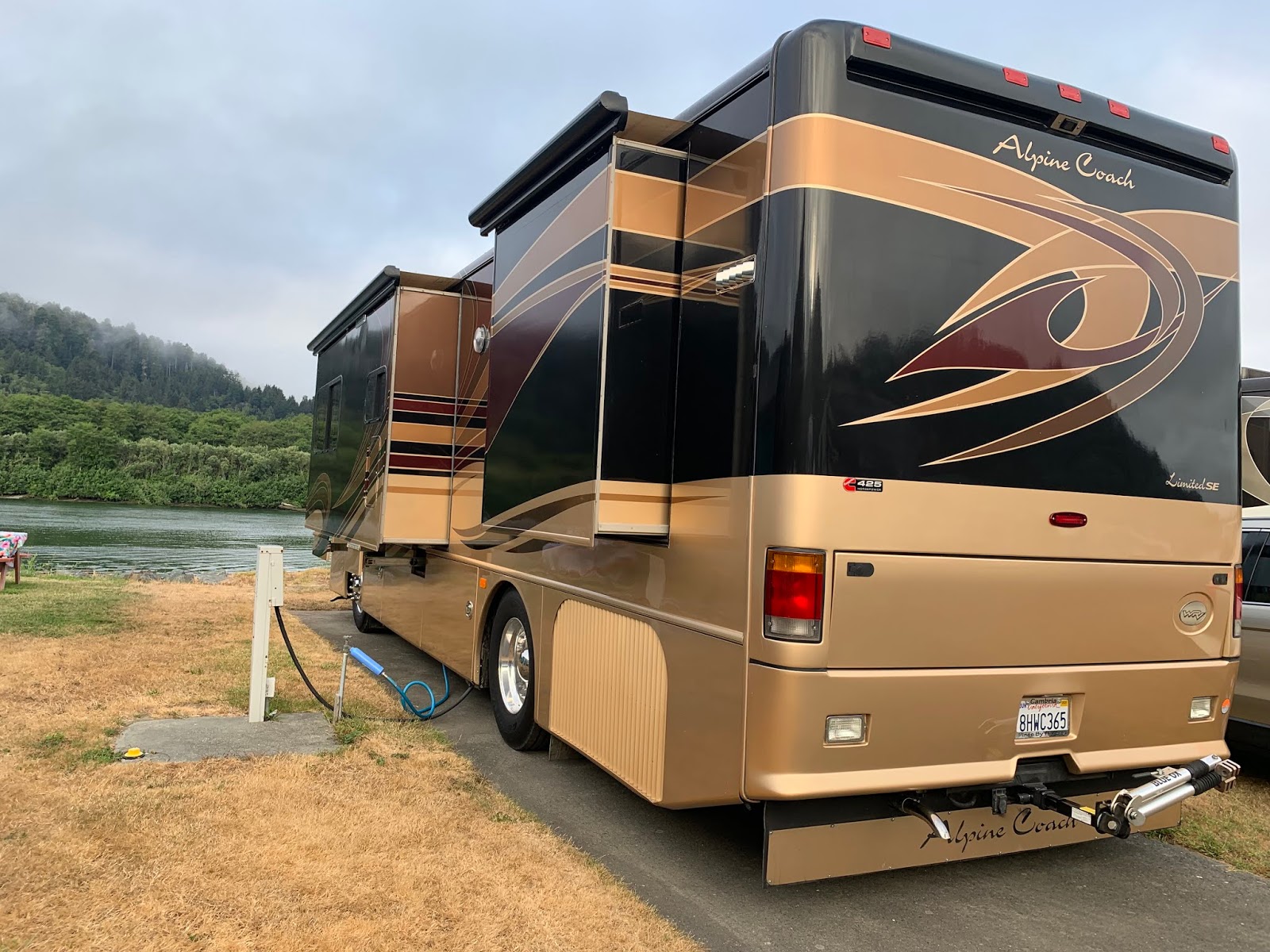
The North Fork of the Middle Fork of the Willamette River was designated as a wild and scenic river in 1988. Water quality is one of the most outstanding attributes of the North Fork as its source, Waldo Lake, is considered one of the purest in the world. Located here at the confluence of the North Fork and Middle Fork is Casey's Riverside RV Park, one of our favorite destinations over the years. Driving into the park after such a long hiatus brought a big smile to both of us for the setting was just as beautiful as years past and the park was perfectly groomed.
 |
| confluence of the North Fork and Middle Fork of the Willamette River |
The serenity of this river provided us such peaceful moments, soothed our mental aches and brought a world of joy, so it came easy to view it as a metaphor of life. Akin to this river, our thoughts and dreams are always in motion, never sure where true consciousness of our life began, let alone where it will finally end. And while we can sometimes see farther up stream or downstream, I find it difficult to see the vast scheme of our path.
If we were our dogs, we wouldn't dwell on such silly thoughts...just frolic and get wet.
This week was special as we shared this beautiful waypoint with old and new friends. Seven years ago at this same campground we met Jeff and Janice and have stayed in touch over the years. No sooner had we arrived, we get a text from Janice saying they were camped at Caseys in case we had plans to visit...what a mind blowing coincidence. During this brief reunion we noted that we both had gotten new travel mobiles and added a four-legged companion to our pack. We made time to have dinner at our favorite local Chinese restaurant and polish off few glasses of wine as we caught up on the years past lowlights and highlights.
 |
| Janice, Tacoma and Jeff |
 |
| Stephen, Kayla and Orlena |
We also had our dear friends Stephen and Orlena share a vacation with us. As Orlena was recovering from a recent knee surgery, her mobility was reduced and cane assisted. But the river provided many nourishing moments for her to detach from the physical pain and frustration of walking in SloMo. We did get a chance to share many meals, a few walks, had competitive game nights and each evening we listened to Stephen "fondle" his acoustic guitar.
 |
| Joyce, Dennis and Tilley |
And by a synchronicity moment, we connected with Dennis and Joyce. It was weird...for Imkelina had more in common with Joyce than a pair of twins. Dennis and I just look alike...but he plays guitar far better than me.
With two guitarists within our circle, we had a couple of jam nights hosted by Dennis and Stephen. Fun evenings for sure! Dennis also participated in an open mike night at Oregon's only real Ale House and Brewery, Brewers Union Local 180. He was definitely the highlight of the night.
If the Willamette National Forest draws you to visit the area, check out the Diamond Creek Falls Loop Trail to experience some beautiful falls, including the Salt Creek Falls, the second highest fall in Oregon.
In 2015, our dear friends, Dick and Melinda, took us on a wonderful road trip of special waypoints near their then home base in Redmond. One of those places, the McKenzie River, sparked our desire to return and spend multiple days exploring. Well...we came back! We were pleasantly surprised to find McKenzie Bridge, a small US Forest Service campground on the bank of the river, with a couple of sites large enough for our motorhome. Granted we needed a shoehorn get positioned just right.
This campground was special and a waypoint to which we will definitely return. Each morning mists rose above the water with the laziness of summer. Watching the river's ripples and rolls through the hazy light was meditating, while the rocky bank hypnotized us with its rainbow of colorful stones. Our sanctuary on this tiny beach was a very healing spot to give thanks, be in the moment and rest our body and soul.
Three thousand years ago, a volcanic eruption in Central Oregon pushed a giant flow of lava southwest toward the McKenzie River. The lava scorched the forest and redirected the flow of the river, creating this beautiful gem...Clear Lake. It is considered one of the clearest and coldest lakes in the Cascades. Ospreys filled the skies above the lake. We never seen so many in one place. The 4.6 mile Clear Lake Loop Trail winds through the lava beds and old growth forest and is pet friendly. As we were alone on the trail, Sydney and Kiah celebrated off leash.  The changing colors in the forest gave notice that fall was tugging away at summer...the year's last and loveliest smile signaled us, it was time to move on.
At Waypoint 44.175º N, 122.175º W


 The Klamath River, a federally protected "Wild and Scenic River," is one of three rivers flowing from the Cascade Mountains and reaching the Pacific Ocean. The river, home to our Native Americans for thousands of years, still rely on and care for the river today. The town of Klamath, on the California North Coast, is situated at the mouth of the river and is within the Yurok Indian Reservation.
 Klamath River salmon and steelhead runs were once the third-largest in the nation, but have fallen to just eight percent of their historic numbers as dams block over 300 miles of historic salmon habitat. Our fisherman neighbors shared that their success rate has been hit and miss, due to river's warm water temperatures. Although the Chinook salmon are staying off shore in the cooler water, they did score an occasional fish for the grill.

 As our site at, Golden Bear RV Park, was right on the bank of the Klamath, we owned a perfect perch for wildlife viewing. We were told that the Klamath Basin is also home to mule deer, elk, cougar, black bears and river otters. We saw elk grazing on the side of the road, a family of river otters playing on the opposite bank and Osprey. And the neighbors spotted a black bear swimming across the river in front of the park the day before we arrived.

 The Rogue River, another river beginning in the Cascades and flowing to the Pacific at Gold Beach. This river became our next host for a few days. Just a few miles up the road from Gold Beach was Quosatana Campground, a very nice National Forest campground with large enough sites to accommodate our beast. It is situated in an Oregon myrtle grove with broad grass meadows on a rocky bank above the river.
 The North Fork of the Middle Fork of the Willamette River was designated as a wild and scenic river in 1988. Water quality is one of the most outstanding attributes of the North Fork as its source, Waldo Lake, is considered one of the purest in the world. Located here at the confluence of the North Fork and Middle Fork is Casey's Riverside RV Park, one of our favorite destinations over the years. Driving into the park after such a long hiatus brought a big smile to both of us for the setting was just as beautiful as years past and the park was perfectly groomed.
 This week was special as we shared this beautiful waypoint with old and new friends. Seven years ago at this same campground we met Jeff and Janice and have stayed in touch over the years. No sooner had we arrived, we get a text from Janice saying they were camped at Caseys in case we had plans to visit...what a mind blowing coincidence. During this brief reunion we noted that we both had gotten new travel mobiles and added a four-legged companion to our pack. We made time to have dinner at our favorite local Chinese restaurant and polish off few glasses of wine as we caught up on the years past lowlights and highlights.
 We also had our dear friends Stephen and Orlena share a vacation with us. As Orlena was recovering from a recent knee surgery, her mobility was reduced and cane assisted. But the river provided many nourishing moments for her to detach from the physical pain and frustration of walking in SloMo. We did get a chance to share many meals, a few walks, had competitive game nights and each evening we listened to Stephen "fondle" his acoustic guitar.
 With two guitarists within our circle, we had a couple of jam nights hosted by Dennis and Stephen. Fun evenings for sure! Dennis also participated in an open mike night at Oregon's only real Ale House and Brewery, Brewers Union Local 180. He was definitely the highlight of the night.

 If the Willamette National Forest draws you to visit the area, check out the Diamond Creek Falls Loop Trail to experience some beautiful falls, including the Salt Creek Falls, the second highest fall in Oregon.

 In 2015, our dear friends, Dick and Melinda, took us on a wonderful road trip of special waypoints near their then home base in Redmond. One of those places, the McKenzie River, sparked our desire to return and spend multiple days exploring. Well...we came back! We were pleasantly surprised to find McKenzie Bridge, a small US Forest Service campground on the bank of the river, with a couple of sites large enough for our motorhome. Granted we needed a shoehorn get positioned just right.


 This campground was special and a waypoint to which we will definitely return. Each morning mists rose above the water with the laziness of summer. Watching the river's ripples and rolls through the hazy light was meditating, while the rocky bank hypnotized us with its rainbow of colorful stones. Our sanctuary on this tiny beach was a very healing spot to give thanks, be in the moment and rest our body and soul.

 Three thousand years ago, a volcanic eruption in Central Oregon pushed a giant flow of lava southwest toward the McKenzie River. The lava scorched the forest and redirected the flow of the river, creating this beautiful gem...Clear Lake. It is considered one of the clearest and coldest lakes in the Cascades. Ospreys filled the skies above the lake. We never seen so many in one place. The 4.6 mile Clear Lake Loop Trail winds through the lava beds and old growth forest and is pet friendly. As we were alone on the trail, Sydney and Kiah celebrated off leash.