Volcanoes...just another graphic description of Nature's wildness or just its beauty making love-beats of its heart.
Within the Cascades you will behold a range of exhausted volcanoes, not a flame on any majestic crest...but many a fire burns beneath the ground. A dormant fire mountain is only temporary, as proven in May 1980, when the most disastrous volcanic eruption in US history occurred.
Mount St. Helens is located in the Cascade Range and is part of the Cascade Volcanic Arc, a segment of the Pacific Ring of Fire that includes over 160 active volcanoes.
 |
| The collapse of the northern flank of Mount St. Helens is still quite visible today. |
 |
| Life has returned to the valley surrounding the volcanoe. |
 |
| Scars of landslide still exist. |
A 5.1 earthquake at Mount St. Helens on Sunday, May 18th 1980 triggered the entire north face to slide away. In reducing the elevation of the mountain's summit by over 1,300 feet, the quake created the largest landslide ever recorded. Molten high pressure gas and steam rich gas in the volcano exploded northward and rose 80,000 feet into the atmosphere, depositing ash in 11 western states. When it was all over, approximately 57 people were killed directly from the lateral blast, mudslides or flooding.
We camped at Seaquest State Park, a 475 acre forested park along the shoreline of Silver Lake. It was 47 miles to the Johnston Ridge Observatory, located in the heart of the blast zone, which is a wonderful interpretive center with spectacular views of the crater. Our site was surrounded by a thick canopy of moss filled trees and had "islands" of new growth of grass, which kept Sydney and Kiah mud free (most of the time) between rain storms.
 |
| Coldwater Lake Trail |
 |
| Interpretive boardwalk at Coldwater Lake |
 |
| One mile boardwalk trail around Silver Lake Wetlands |
Coldwater Lake, Castle Lake, Spirit Lake and Silver Lake were all created by eruptions of Mount St. Helens. Imkelina and her loyal pack took every "dry" opportunity to explore off the beaten track the many wetland and woodland trails. With the colors of fall creeping in throughout the forest canopy, these nature paths were even more spectacular.
 |
| Clouds shroud the face of Mt. Rainer |
 |
| and there are more clouds |
"Of all the fire-mountains which, like beacons, once blazed along the Pacific Coast, Mount Rainier is the noblest."
John Muir
We made attempt after attempt to gain an audience with majestic Mount Rainer in hopes of seeing magical views of brilliantly colored meadows, dazzling, roaring falls and mighty snow covered pinnacles. But alas, after four full days of going up to the mountain we only saw the veil of clouds that protected and blocked that breathtaking peak.
 |
| Skyline Trail |
 |
| Grove of the Patriarchs Nature Trail |
 |
| Myrtle Falls |
 |
| Reflection Lake |
At the Henry M. Jackson Memorial Visitor Center at Paradise, steps carved with a welcome from John Muir lead you to many trailheads, meadows and falls nestled throughout Mount Rainier. You will behold all the splendor and wonderment within this stunning National Park. During our brief time at Rainer, meadows upon meadows were just beginning to be filled with brilliant color. Wildflowers in every shade swayed in the breeze, bringing life to the hillside.
 |
| The Blue Hole |
With its proximity to Mount Rainer, we camped at La Wis Wis Forest Service Campground during our stay. It turned out to be an excellent base to explore. Situated at the confluence of three waterways, the campground is nestled under a lush canopy of towering Douglas firs and red cedars. Our riverbank site in the Hatchery Loop accommodated our WeBeGone with room to spare, but the campground lets you know that roads through it are narrow with large trees lining it's boundary and before you cross the river bridge you best practice squeezing your butt cheeks. Turns are very, very tight. Many motorhome side panels have felt the teeth of the bridge as they tried to make the turn onto its ramp. A short hike from our campsite was the Blue Hole, a beautiful pool located on the Ohanapecosh River that locals are bold enough to plunge into from the cliffs above.
And than there is the wildlife...
While on the trail, we came upon Hoary Marmots posing on the hillsides. Huge piles of bear scat on the trail warned us to be on the lookout for foraging black bears. Our vigilance paid off as a short distance up the trail we came upon one of Mt. Rainier's largest carnivores. Based on the size of this bear, we assumed this was a huge male and we gave the big boy a wide berth.
Our Mount Rainer experience was incomplete, so a return visit is a must. Heck, this is THE mountain that's emblazoned on every Washington license plate and being the US fifth highest peak, is visible throughout much of the western state. Rainier is awe-inspiring and we are hooked.
 |
| Mount Rainier as captured by Danny Seldman |
This photo represents what we envision seeing upon our return to Mount Rainer.
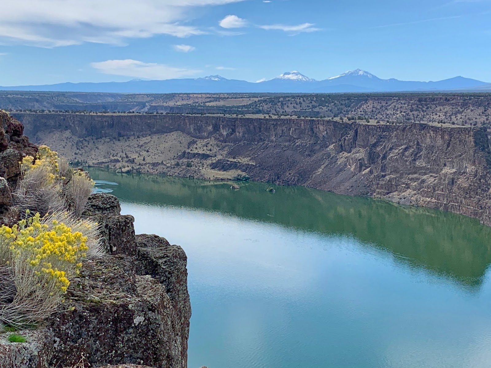
Heading south we decided to check out Cove Palisades State Park on Billy Chinook Reservoir in Culver, Oregon. The last time we stopped here, the lake was bustling with boaters, fisherman, campers and hikers. The hordes of people resembled and compared to stirring up an ant colony. Not a time for nourishment, quiet evenings and nature songs. As this was the off season, we decided it was a good time to try staying at one of their facilities, Crooked River Campground, encompassing the Deschutes and Crooked River Canyons. Perfect timing too...with over 200 campsites, we found only about a half dozen occupied. We secured the most awesome campsite that offered a magical view of the second highest mountain in Oregon, the stratovolcano Mount Jefferson.
 |
| Mount Jefferson |
And as history has proven, the awakening of a slumbering fire mountain can be so spectacular with its erupting...showing its raw destructive power capable of so much destruction. There must be a connection between the mountains, forest and us...as we often gravitate to them. Imke and I crave for solace deep in our hearts and we find that in those natural wonderlands. And we find peace in the silence and beauty that these magical surroundings offer. We do love the PNW.
 |
| Lenticular Clouds over Mount St. Helens |
At Waypoint 46.8523º N, 121.7603º W

 Mount St. Helens is located in the Cascade Range and is part of the Cascade Volcanic Arc, a segment of the Pacific Ring of Fire that includes over 160 active volcanoes.


 We camped at Seaquest State Park, a 475 acre forested park along the shoreline of Silver Lake. It was 47 miles to the Johnston Ridge Observatory, located in the heart of the blast zone, which is a wonderful interpretive center with spectacular views of the crater. Our site was surrounded by a thick canopy of moss filled trees and had "islands" of new growth of grass, which kept Sydney and Kiah mud free (most of the time) between rain storms.
 Coldwater Lake, Castle Lake, Spirit Lake and Silver Lake were all created by eruptions of Mount St. Helens. Imkelina and her loyal pack took every "dry" opportunity to explore off the beaten track the many wetland and woodland trails. With the colors of fall creeping in throughout the forest canopy, these nature paths were even more spectacular.


 And than there is the wildlife...
 Our Mount Rainer experience was incomplete, so a return visit is a must. Heck, this is THE mountain that's emblazoned on every Washington license plate and being the US fifth highest peak, is visible throughout much of the western state. Rainier is awe-inspiring and we are hooked.


 Heading south we decided to check out Cove Palisades State Park on Billy Chinook Reservoir in Culver, Oregon. The last time we stopped here, the lake was bustling with boaters, fisherman, campers and hikers. The hordes of people resembled and compared to stirring up an ant colony. Not a time for nourishment, quiet evenings and nature songs. As this was the off season, we decided it was a good time to try staying at one of their facilities, Crooked River Campground, encompassing the Deschutes and Crooked River Canyons. Perfect timing too...with over 200 campsites, we found only about a half dozen occupied. We secured the most awesome campsite that offered a magical view of the second highest mountain in Oregon, the stratovolcano Mount Jefferson.
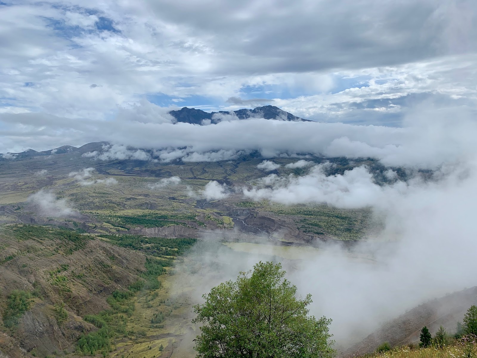


No comments:
Post a Comment